Red weather alert issued as Norway braces for 'Storm Ingunn'
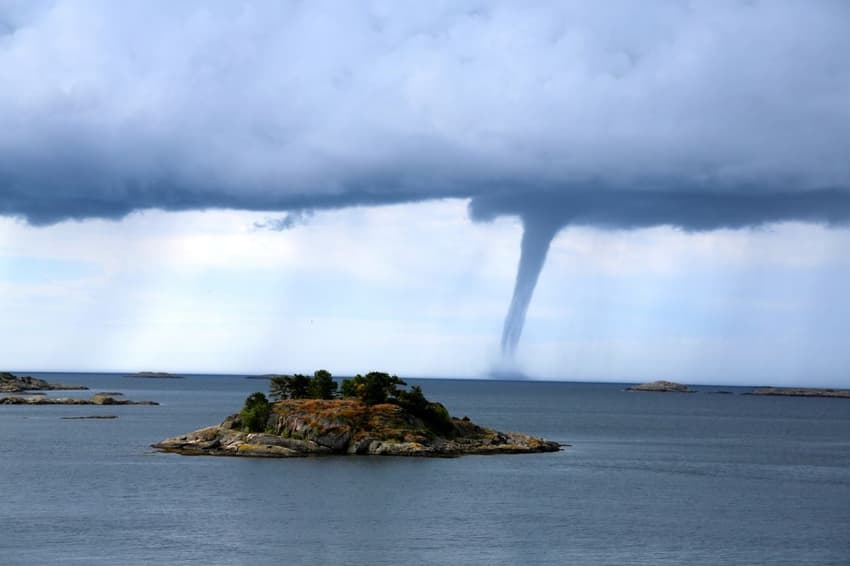
Hurricane-force winds are set to batter western and central Norway, and meteorologists have warned that it will be dangerous to be outside and that travel will be disrupted on Wednesday.
Gusts of up to 180 Km/h are expected in the southwest, when “Storm Ingunn” makes landfall on Wednesday.
A red danger warning has been issued for parts of Nordfjord, Møre and Romsdal, Trøndelag and Helgeland.
When a red weather warning is issued, the public is advised to secure valuables. During red weather events it's, “very likely there will be widespread damage, travel and power disruption and even risk to life,” according to Norwegian forecasting site Yr.
READ ALSO: What you need to know about Norway’s weather warning system
“Now Ingunn is coming, and it is central Norway and western Norway that will feel it,” state meteorologist Geir Ottar Fagerlid told public broadcaster NRK.
“It is important to take precautions. When there’s a hurricane, you shouldn’t be outdoors,” he said.
The strongest gusts are expected in outer regions from Stad to Helgeland.
Below you can see a forecast for Storm Ingunn.
Ekstremværet "Ingunn" ⚠️🛑
Vi har sendt ut rødt farevarsel om ekstremt kraftige vindkast for deler av Møre og Romsdal, Trøndelag og Helgeland.
Hold deg innendørs og følg råd fra beredskapsmyndigheter.
👉 https://t.co/8Onz8FMBft pic.twitter.com/1BPs7gB9N9
— Meteorologene (@Meteorologene) January 30, 2024
Meteorologists have said journeys would be affected, and flights, ferries and public transport would likely be disrupted. Bridges and roads were also likely to be closed.
In addition, forecasters have warned that it will be dangerous to be outside, and damage to buildings, infrastructure, forests and power grids was expected. High tides were also likely to damage property in coastal areas.
The public in the affected areas has been warned to stay inside and follow the advice of the authorities. Those who must drive will need to check the Norwegian Public Roads Administration for updates.
The weather warning has been issued from Wednesday afternoon until Thursday morning. A yellow danger warning has been issued in eastern Norway on Wednesday and Thursday.
Comments
See Also
Gusts of up to 180 Km/h are expected in the southwest, when “Storm Ingunn” makes landfall on Wednesday.
A red danger warning has been issued for parts of Nordfjord, Møre and Romsdal, Trøndelag and Helgeland.
When a red weather warning is issued, the public is advised to secure valuables. During red weather events it's, “very likely there will be widespread damage, travel and power disruption and even risk to life,” according to Norwegian forecasting site Yr.
READ ALSO: What you need to know about Norway’s weather warning system
“Now Ingunn is coming, and it is central Norway and western Norway that will feel it,” state meteorologist Geir Ottar Fagerlid told public broadcaster NRK.
“It is important to take precautions. When there’s a hurricane, you shouldn’t be outdoors,” he said.
The strongest gusts are expected in outer regions from Stad to Helgeland.
Below you can see a forecast for Storm Ingunn.
Ekstremværet "Ingunn" ⚠️🛑
— Meteorologene (@Meteorologene) January 30, 2024
Vi har sendt ut rødt farevarsel om ekstremt kraftige vindkast for deler av Møre og Romsdal, Trøndelag og Helgeland.
Hold deg innendørs og følg råd fra beredskapsmyndigheter.
👉 https://t.co/8Onz8FMBft pic.twitter.com/1BPs7gB9N9
Meteorologists have said journeys would be affected, and flights, ferries and public transport would likely be disrupted. Bridges and roads were also likely to be closed.
In addition, forecasters have warned that it will be dangerous to be outside, and damage to buildings, infrastructure, forests and power grids was expected. High tides were also likely to damage property in coastal areas.
The public in the affected areas has been warned to stay inside and follow the advice of the authorities. Those who must drive will need to check the Norwegian Public Roads Administration for updates.
The weather warning has been issued from Wednesday afternoon until Thursday morning. A yellow danger warning has been issued in eastern Norway on Wednesday and Thursday.
Join the conversation in our comments section below. Share your own views and experience and if you have a question or suggestion for our journalists then email us at [email protected].
Please keep comments civil, constructive and on topic – and make sure to read our terms of use before getting involved.
Please log in here to leave a comment.